The following summary has been condensed for length and readability. To listen to the full discussion, click . This episode is sponsored by and .
In this episode of The Broadband Bunch, host Brad Hine welcomes Jay Cadman, Senior Vice President of IQGeo, for a discussion on how broadband providers are leveraging geospatial intelligence and AI to transform the way networks are planned, built, and maintained. With more than three decades of experience in telecom, Jay brings a global perspective and operational insight into how data-driven strategies and field-to-office integration are powering the next evolution of broadband.
From digital twins to AI-enabled field data collection, Cadman outlines the critical tools and strategies broadband providers need to remain agile and efficient in today’s increasingly complex infrastructure landscape.
A Global Career in Telecom and Geospatial Strategy
Jay Cadman’s career spans over 30 years, with leadership experience at both multinational corporations and fast-growing startups. His expertise includes everything from network engineering and planning to operations and sales, and his roles have taken him across North America, Europe, and Asia.
Cadman was also a founding member of IQGeo, a company originally focused on field operations but now offering end-to-end broadband network management solutions. IQGeo serves over 500 customers globally—including major telecom operators like AT&T, Bell Canada, and Telus—as well as regional ISPs, utilities, universities, and private networks. This diverse customer base has allowed Cadman and his team to see network deployment and maintenance challenges from multiple vantage points, helping shape a product that is highly configurable, scalable, and easy to use.
IQGeo: Bridging the Gap Between Field and Office
A central theme in the conversation is the persistent disconnect between the office and the field in network management. Many broadband operators continue to struggle with outdated or incomplete records, manual workflows, and siloed systems that make real-time decision-making difficult. IQGeo’s mission, according to Cadman, is to solve that problem by enabling seamless communication and data-sharing between all stakeholders involved in the network lifecycle.
IQGeo’s software platform is browser- and mobile-based, providing accessibility without the need for heavy desktop software. This design ensures that field technicians can collect and access data in real time, directly at the point of work. The result is more accurate data, reduced operational friction, and faster resolution of issues in the field.
“The technician standing in front of the plant usually has the best information,” Cadman explains. “We want to equip them to capture that data quickly and accurately—and have it instantly reflected in the system of record.”
Why Digital Twins Are Essential to Broadband’s Future
Much of IQGeo’s strategy centers around the concept of the digital twin—a virtual model of the physical broadband network that can be continuously updated with field data. While digital twins have been used in industries like manufacturing and construction, broadband has lagged behind due to challenges in data collection, system integration, and scalability.
Cadman emphasizes that a digital twin is only useful if it accurately reflects real-world conditions. The biggest industry challenge, he says, is that most network records are outdated or incomplete, limiting the ability of broadband providers to automate operations or deploy AI tools effectively.
“When the digital twin is out of sync with what’s in the field, you’re rolling trucks unnecessarily,” he says. “That costs time and money and adds risk. The key is keeping the digital twin aligned with reality.”
To address this issue, IQGeo recently acquired a visual AI company based in France. By integrating computer vision technology, IQGeo can now analyze photos and video captured by field crews to automatically update the digital twin with new data. This eliminates the lag between work in the field and updates in the system, providing real-time visibility and reducing the burden of manual updates.
The Role of AI in Field Data Collection and Automation
One of the most exciting parts of the conversation is Cadman’s deep dive into how AI is being used to drive new levels of automation and insight in broadband operations.
Traditionally, broadband providers have relied on human input to keep network records up to date. But by leveraging AI and image recognition, IQGeo can now validate, interpret, and categorize visual data—automatically identifying discrepancies between the field and existing records. For example, a field technician might photograph a splice or pole, and IQGeo’s AI will analyze the image, compare it to known data, and flag any differences for review or automatic correction.
This field-sourced data becomes a continuous feedback loop, ensuring the digital twin remains accurate while minimizing manual input and administrative effort.
“It’s about more than just gathering data—it’s about making that data actionable,” Cadman notes. “AI gives us a way to scale that process, reduce errors, and create a living model of the network.”
Usability and Design Inspired by Google Maps
Cadman credits Google Maps as a key moment of transformation in the way people think about geospatial data. Before smartphones and mapping apps became ubiquitous, GIS was considered a highly specialized, expert-only field. Google Maps changed that by making spatial data intuitive, accessible, and useful for everyone.
IQGeo has taken a similar approach to product design. Rather than building tools for GIS specialists alone, their platform is designed for everyday users—field techs, planners, engineers, and customer service teams—who need clear, accurate, and easy-to-use information in real time.
“Everyone expects usability and simplicity now,” says Cadman. “That’s the benchmark, and that’s what we aim to deliver.”
Leading Global Teams and Scaling Smart
The conversation also touches on Cadman’s leadership journey—specifically, the challenges and rewards of building global teams. IQGeo has grown through both organic development and acquisitions, including companies in Belgium, Utah, and France. Bringing these teams together under a unified vision required not only operational alignment, but cultural sensitivity and a commitment to shared goals.
Cadman shares that one of his biggest lessons has been learning how to communicate across departments, geographies, and technical disciplines. For example, he notes that engineering teams often use language and acronyms that make sense internally but may be confusing to contractors or external partners.
“It takes a lot of listening, a lot of patience, and a real effort to understand the perspective of others,” he reflects. “Whether it’s your own team or a customer, success comes from shared understanding.”
A Personal Path Through Geospatial Technology
Toward the end of the episode, Cadman reflects on his personal journey into the geospatial world. His father was an engineering leader at Smallworld, an early geospatial software company based in Cambridge, UK. Jay spent his teenage years surrounded by discussions of GIS architecture and product development, and eventually helped open the U.S. office in the early 1990s.
After Smallworld went public and was acquired by GE, Cadman realized he was more aligned with smaller, fast-moving companies than large corporations. That experience laid the groundwork for launching IQGeo and other startups focused on solving geospatial challenges in intuitive and scalable ways.
His advice for younger professionals: dive into the commercial side of technology early—sales, marketing, packaging, and pricing are just as important as the tech itself. “I wish I had become obsessive about those areas 10 years earlier,” he admits.
Looking Ahead: Where Broadband Operations Are Headed
As the episode wraps, Cadman emphasizes that the broadband industry still has a long way to go in terms of automation, data quality, and digital transformation. But with tools like AI and geospatial intelligence maturing quickly, providers now have the opportunity to build smarter, more efficient networks—ones that are proactive rather than reactive.
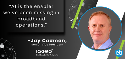
“It’s an exciting time,” Cadman concludes. “AI is the enabler we’ve been missing. It’s going to fundamentally change how broadband networks are operated, and we’re just getting started.”
© 2025 Enhanced Telecommunications.