
GIS Partners
Broadband and telecom service providers manage networks that span wide geographic areas with thousands of devices spread across multiple service territories. Geographic information system technology turns that physical network into a visual, data-rich layer that connects device health, subscriber impact, and network performance to real-world locations. ETI partners with Esri, the global leader in GIS software, to bring geospatial integration directly into your daily operations.
ETI and Esri: Bringing Geospatial Data Into Telecom Operations
ETI is an award-winning Esri partner, recognized at the 2020 Esri Partner Conference with the Fostering Engagement Award for “compelling use of Esri technology to drive systems of engagement with innovation in telecommunications.” The partnership brings enterprise GIS capabilities directly into ETI’s Intelegrate Observe platform through Esri’s ArcGIS environment
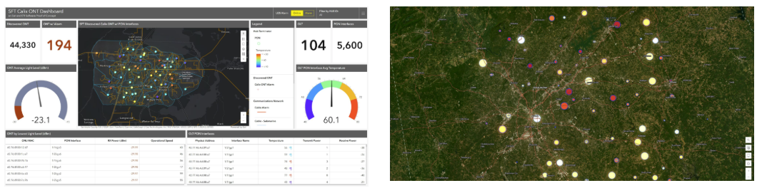
ETI’s Intelegrate Observe is built on the Esri Geospatial Cloud, pulling real-time telemetry from any TR-069 enabled CPE and displaying it on a web map with spatial data tied to device location, service area, and subscriber impact. The dashboard also captures historical data for network trending analysis, giving operations and engineering teams the geographic information they need to make informed decisions about capacity planning, maintenance, and buildout priorities.
 Are you an Esri reseller? Contact us to learn how ETI’s platform works with ArcGIS.
How GIS Powers Your Daily Operations
GIS data integration gives your team more than a map. It connects data from different sources, including provisioning, device telemetry, billing, and field service, into one geospatial view that supports real-time decision-making across departments.
Practical use cases include:
- Outage response: See which devices are affected, where they are, and how many subscribers are impacted before dispatching a technician
- Capacity planning: Use GIS data and spatial data to identify areas with high demand or recurring performance issues to prioritize network investment
- Field service: Give technicians geographic context on device location and status before they arrive on site, reducing time on the ground
- Asset management: Track network equipment across your service territory with integrated analysis that ties device health to physical location and service area data
When geospatial data flows into the workflows your teams already use, the result is greater operational efficiency, faster response times, and better data quality across your operation.

Frequently Asked Questions
What GIS platform does ETI integrate with?
ETI partners with Esri and builds directly on the ArcGIS platform. ETI’s Unified Device Management solution runs on the Esri Geospatial Cloud, bringing real-time device data into the same GIS environment your team already uses.
What kind of data does ETI display in the GIS view?
The dashboard displays real-time device health, subscriber impact, alarm data, and network performance metrics on a web map tied to geographic locations. It also stores historical data for trending and integrated analysis.
Do I need to be an existing Esri customer to use ETI's GIS capabilities?
The geospatial integration is built on the Esri platform, so an Esri license is part of the setup. Contact our team to discuss your current GIS workflow and how ETI fits in.
Can ETI's GIS integration support both real-time monitoring and long-term planning?
Yes. The platform captures real-time device telemetry for immediate operational response and stores historical geospatial data for trending, capacity planning, and informed decisions about where to invest in your network.
Is ETI an official Esri partner?
Yes. ETI is an award-winning Esri partner, recognized with the Fostering Engagement Award at the 2020 Esri Partner Conference for innovation in telecommunications.